


18 July 2024
|
 Year 5 pupils studying the burial register for St Mary's Church Woodham Ferrers Essex
Learn how cutting-edge technology (in the form of a Pegasus backpack – one of only two in the whole UK), and historic documents (in the form of parish burial registers) are being combined in a project to survey every gravestone in an Essex churchyard since 1558.
The project’s goal is to create a state-of-the-art interactive map that sets out every gravestone to scale and allows users to zoom in and out, discovering information and images relating to ALL of the individuals laid to rest at St Mary’s since 1558.
Utilising a Pegasus backpack (one of only two in the whole UK) the churchyard of St Mary’s Church in Woodham Ferrers, is being GPS mapped. Experts in burial mapping, AG Intl, are surveying the location of every memorial both within the church and in the churchyard.
Creating an interactive burial map
“The results of this survey will be added to photographs of each memorial in situ,” explain Essex Society for Family History, “with scanned images of the corresponding burial register from the Essex Record Office – dating back some 500 years." The state of the art interactive map will set out every gravestone to scale and allows users to zoom in and out.
Find out more about this innovative and inspiring project:
• www.stmarysheritagehub.co.uk
• www.esfh.org.uk
Why is the map needed?
"In the twenty years I served as Churchwarden to St. Mary's one of my regular tasks was fielding enquiries from people looking for grave locations, says Sharon Hutton-Mayson, Project Lead for St Mary’s Heritage Hub.
"Despite our team keeping the churchyard a safe and tidy place to visit, success wasn't guaranteed. In some cases people travelled great distances and left disappointed. In creating this new platform on our website we are providing the most detailed and transparent access possible with the confidence that it will now be preserved for generations to come.”
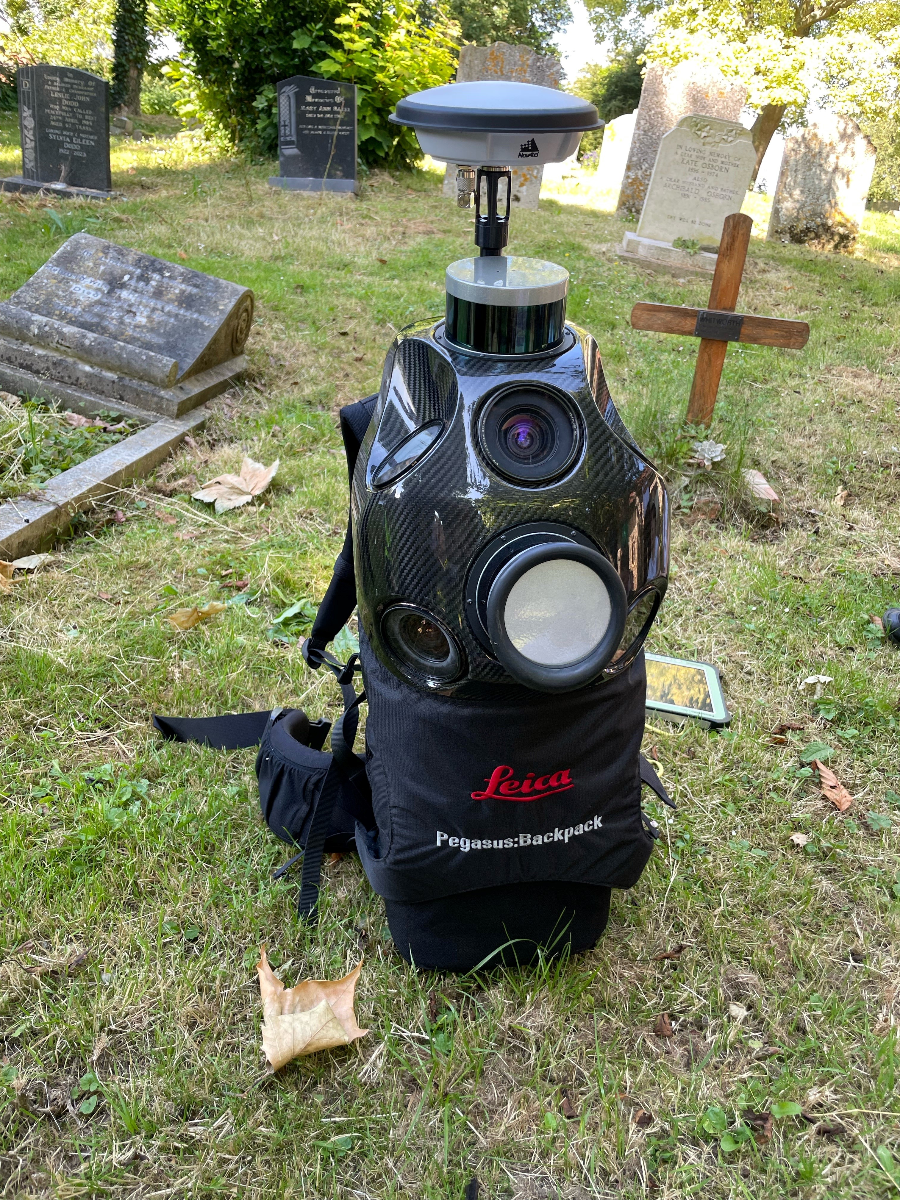
Pegasus the GPS mapping backpack used in Woodham Ferrers churchyard to survey more than 5 centuries of burials
What does the churchyard project involve?
The results of this survey will be added to photographs of each memorial in situ, along with scanned images of the corresponding burial register from the Essex Record Office – dating back some 500 years – to create a state of the art interactive map.
Which organisations are involved in the project?
St Mary’s are being supported in this endeavour by project partners the Essex Society for Family History (ESFH) as part of their ongoing programme of 50 Year Anniversary celebrations.
Andrea Hewitt of ESFH says: “We are delighted to join forces with St Mary’s on this exciting opportunity to engage the general public with family history in a fresh and accessible way. As St Mary’s are the first church in Essex to make such information freely available, we hope that the project will pave the way for other churches across the county as they investigate their own burial sites and the many fascinating stories waiting to be discovered.”
The two organisations have also been joined by budding historians from neighbouring St Mary’s school, who joined AG Intl GPS mapping expert Aaron on Friday 21st June to learn the intriguing ins and outs of the process and get up close and personal with the magnificent mapping backpack!